
Product details
Specifications
Wavelength Range
350 - 1000 nmNumber of Bands
164FWHM
Constant 10 nmMax Resolution
1886 x 1886 pixelWeight
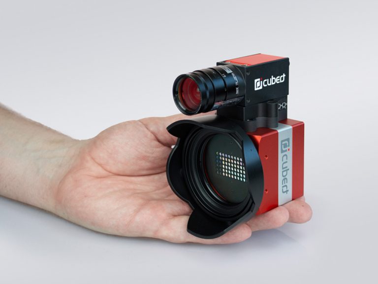
630 gDimensions
86 x 121 x 105 mm
Technology
Light FieldSensor(s)
20 MP & 5 MPSpectral Sampling
4 nmTotal Spectra / Image
168 100 & 3.5 M pansharpenedTotal Data Points (Data Points / Cube)
27 millionData Depths
12 Bit
Readout
Global shutterMax Frame Rate
4 HzIntegration Time
0.1 - 1000 msField of View (FOV)
35°Power Consumption
8 WData Link
2-3 gigE
MORE DATA - MORE DETAIL
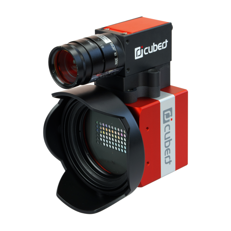
The X20 is extended with a second camera sensor: panchromatic – just one band, high resolution. We use this data to increase the spatial resolution of the spectral camera to 1880 x 1880 pixel, giving incredibly detailed images.
Extra sharp
The extra data provided by the second camera on the ULTRIS X20 Plus allows us to use a technique called pansharpening or image fusion – a version of which we have developed inhouse – to enhance the images even further. This enables analysis at the leaf level of vegetation even from a UAV, helping to detect diseases and other issues that require action at an early stage.
Each ULTRIS X20 Plus comes with a high standard 95% white reference target, a distance target, and all accessories necessary to immediately start measurements.
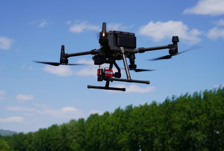
DJI M300 RTK compatible
The ULTRIS X20 Plus is compatible with any drone. For recording data the camera can work in time lapse mode or be triggered directly from the UAV. The image shows the camera onboard a DJI Matrice M300 RTK. It is mounted on a gimbal containing a Windows-based mini computer which runs the Cubert CUVIS software and records the data. The gimbal is connected via DJI-Skyport to the UAV, which triggers the camera automatically during the flight and provides the RTK GPS signal for each single data file.
Comprehensive
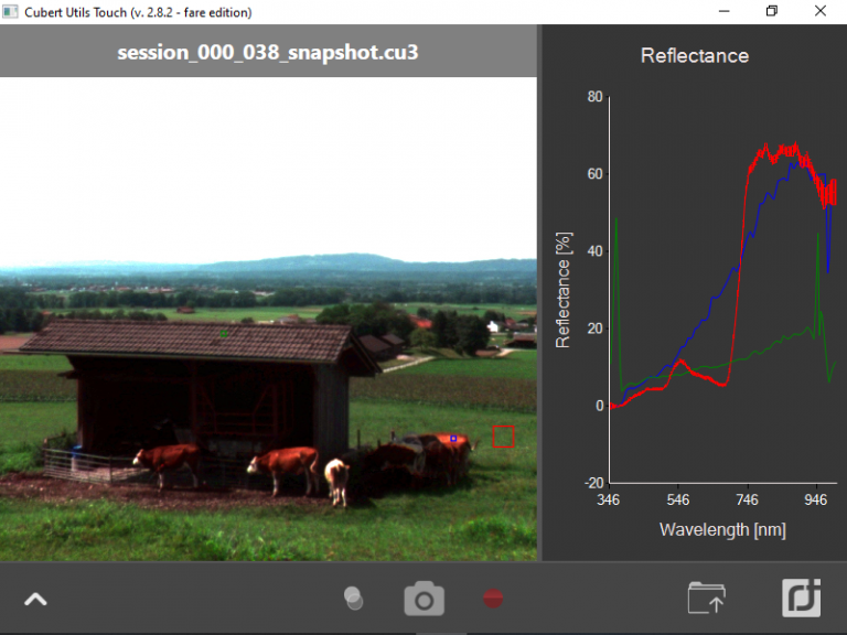
The powerful Cubert Utils software takes raw data, reflectance and even radiance and allows hyperspectral videos at up to 8Hz. It allows first analyses on recorded image cubes, as well as directly on the live data stream. Spectral indices such as Hyperspectral NDVI or Chlorophyll Absorption Integral (CAI), customized plug-ins, and even classification solutions can be directly applied in real-time. The dedicated server allows for autonomous operation during drone flights. While retaining a minimal raw data consumption, the exported data, available in ENVI, Tiff or Multitiff, seamlessly integrates with common GIS and mapping software, including pan-sharpening.
Application field
Aerial Mapping
X20 Plus was designed for aerial mapping, gathering high resolution hyperspectral images. Even though the X20 plus integrates two camera sensors it is still lightweight (less than 690 g), so together with a mini computer and GPS the payload is less than 1.5 kg, making it suitable for a wide range of drones.
Application field
Scientific Research
X20 Plus can, of course, also be used on the ground, whether in the field or in the lab. The non-scanning snapshot allows you to capture the complete data cube within a few milliseconds. The X20 Plus is the right choice for anyone who needs both high resolution and ease-of-use.
Fully compatible with perClass Mira
The machine learning-based analysis tool perClass Mira allows you to quickly find classification solutions for your aerial data. Mira's regression tool provides both quantitive and qualitative statements on your areas of interest, such as a vitality map of crops in a field for instance.
Learn More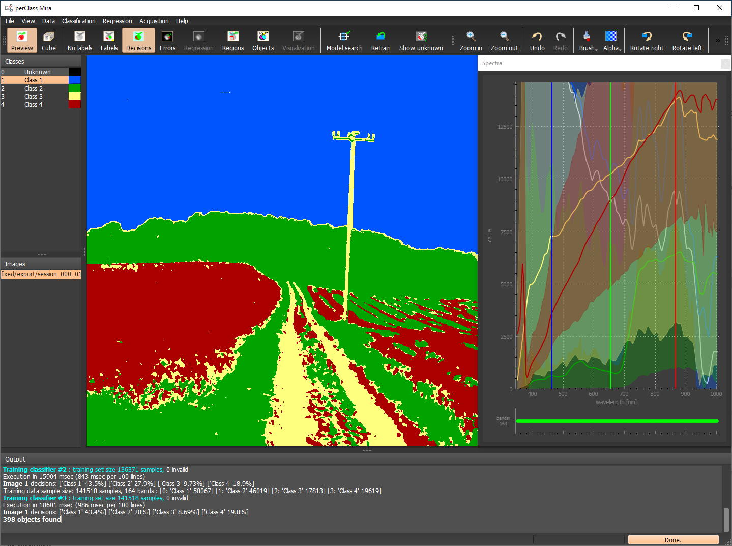
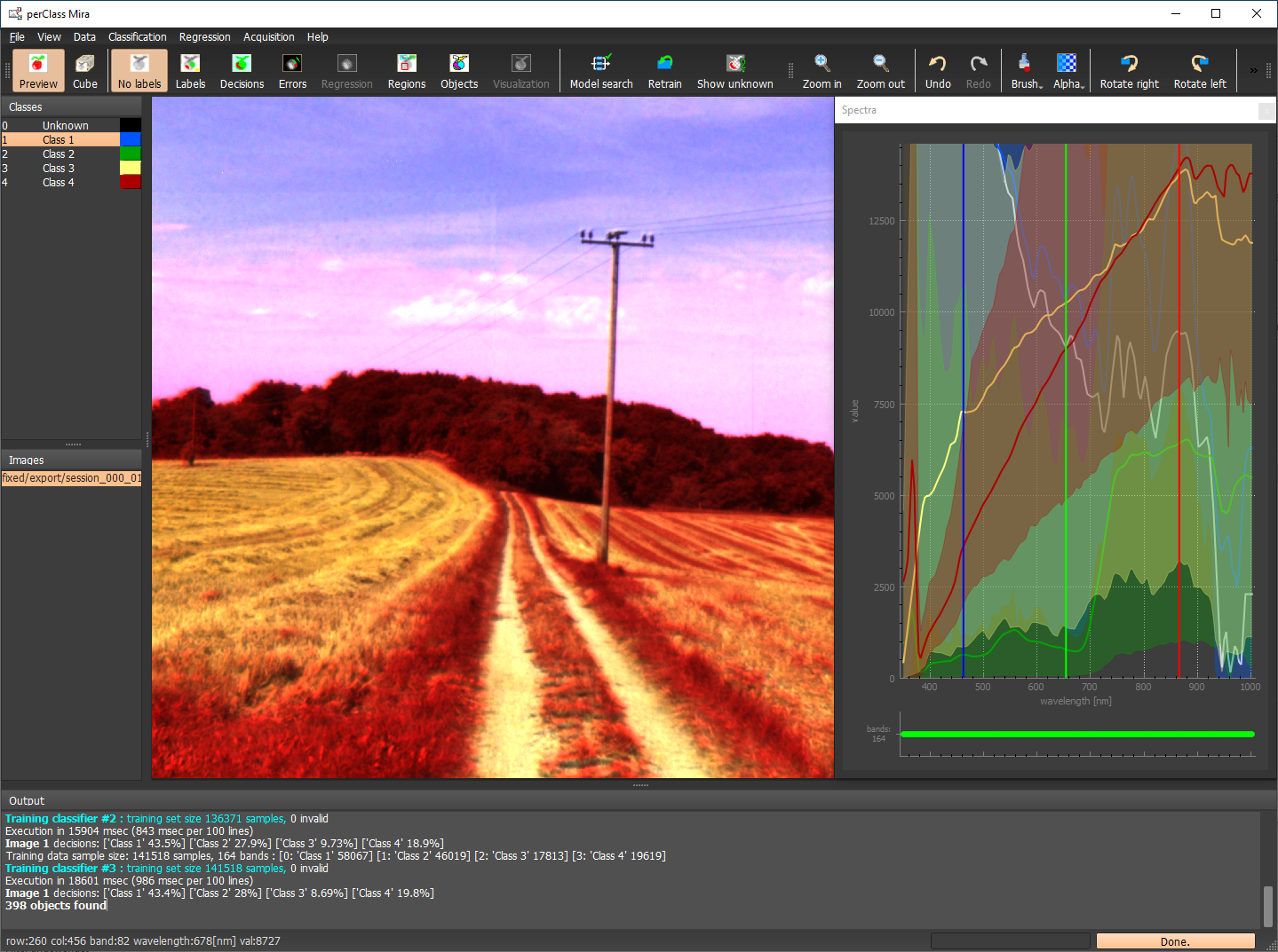
Exported as pansharpened product in ENVI format, read by perClass Mira for classification.
